From the Mountains to the Sound
Navigating the Skagit River means balancing the health of an ecosystem, the needs of a fertile agricultural region, and the fishing rights of First Nations peoples.
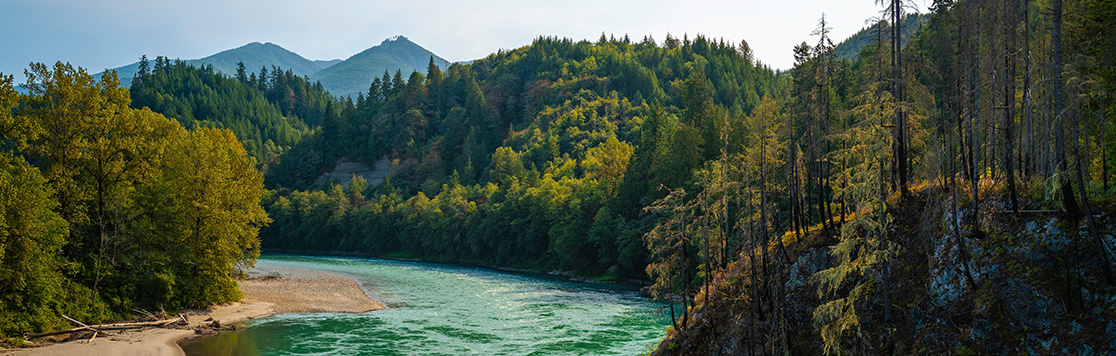
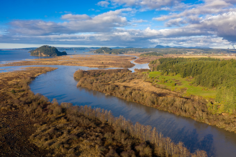
The Skagit River begins in the Cascade Mountains of British Columbia and meets the Puget Sound roughly 60 miles north of Seattle. The river stretches nearly 160 miles through the peaks of Mount Baker and Glacier Peak. Its tributaries, the Sauk, Suiattle, and Cascade Rivers help make up a unique and delicate ecosystem that serves people, wildlife, and habitat. Eight miles above its mouth to Skagit Bay, the main river is separated into two principal channels called the North and South Forks, with Fir Island resting between them.
The Skagit River is named after the Skagit People. Before Europeans arrived, the Upper Skagit tribe occupied the lands along the Skagit, Baker, and Sauk rivers and the Lower Skagit tribe lived in the Whidbey Island area near the mouth of the river. The river was a source of life for these people.
“The Upper Skagit Tribe dwelled in longhouses, scattered all over the banks of the Skagit River. Remains can be dated back eight thousand and five hundred years. The tribe was primarily known for fishing and small-time game hunting. Their cultural patterns follow those of salmon migration upstream.” (Colorado College, Feb. 21, 2023)
Today, the region is still home to the Upper Skagit, Swinomish, and Sauk-Suiattle tribes. For thousands of years, these tribes had a culture that centered around river and saltwater resources. In 1855 the area tribes signed the Treaty of Point Elliott, which guaranteed them certain hunting and fishing rights.
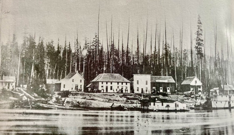
European settlement of the area began in earnest in the 1860s and the new people realized that the floodplain of the Skagit River delta held some of the world’s most promising farmland. But the settlers needed to control the flooding and tidal cycle that regularly occurred on the delta in order to use the land. They worked for years to dike and drain the wetlands, building farms and settling the area with teams of horses and brute strength. Many of them understood how to convert marshes into farmland from their experiences in their homelands of Scandinavia. The delta became roughly 90,000 acres of protected farmland behind miles of dikes and drainage ditches.
“In 1895 the Washington State Legislature allowed landowners to organize into diking districts, which were responsible for maintaining the dikes and protecting the farmland behind them, (Historylink, Farming in the Skagit Valley, 2021).
Using tide gates and drainage ditches, landowners were able to manage the influx of tidal waters and flooding from the river. Oats, hay, barley, and potatoes were the predominant crops during the early years, and vegetable seeds and bulb flowers later became mainstays as well. The area’s soil has proven to be among the best in the world and Skagit County maintains one of the largest and most diverse agricultural communities west of the Cascade mountains. Known for spinach seed, potatoes, and tulips, local farms produce about $300 million worth of crops, livestock, and dairy products.
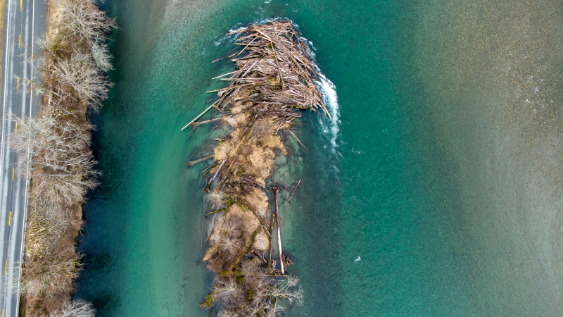
The river over the years, however, has proven unmanageable at times with flooding affecting the region throughout the decades. Flooding continues to be a major concern for landowners and policymakers. The local Upper Skagit, Swinomish, and Sauk-Suiattle tribes have also been working with local landowners and the state for decades to ensure their rights to salmon fishing are upheld amidst the decline in salmon populations along the entire west coast of Canada and the U.S. The management of this unique river’s ecosystem requires balance and provides local food to the greater Seattle region.
Keeping the ecosystem healthy is the priority of all involved in its management, including landowners, local policy leaders, and tribes. This river system exemplifies the necessary respect and determination between neighbors to protect agriculture and tribal fishing rights.
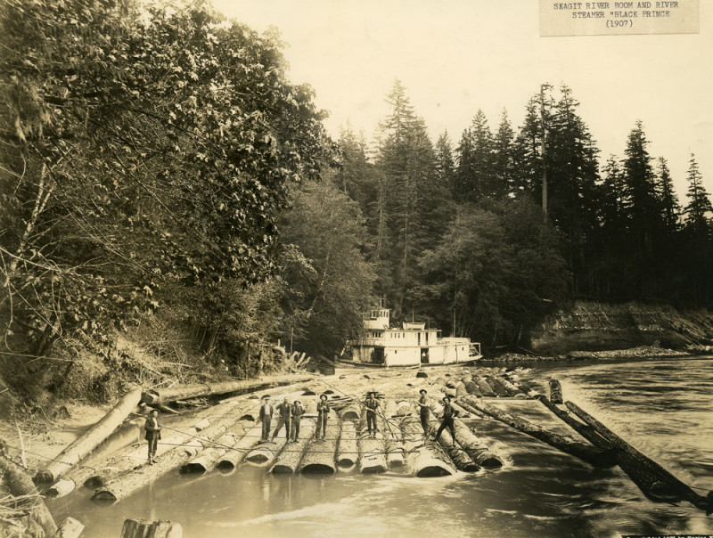
It’s hard to imagine that nearly 150 years ago some of the most fertile farmland in the state was once hindered by a log jam more than a mile long.
“In the summer of 1876, partners Joe Wilson and Donald McDonald begin removing a massive logjam on the Skagit River. For nearly 100 years, its lower section located a half mile below the fledging town of Mount Vernon, has blocked the flow of "ordinary'' river traffic upstream. A rude skid road built by Upper Skagit Indians to haul their canoes around the jam is the only way around it,” (Historylink, Workers begin removing a logjam, 2004).
The logjam occurred naturally long before Europeans arrived, and it took three years to clear the jam sufficiently to allow navigation up and down the river. A memorial was dedicated in 1999 with four large, black metal cutouts depicting the loggers sawing, chopping, prying, and winching the massive logs that impeded the flow of people and goods from the interior of the Skagit Valley to Skagit Bay.

